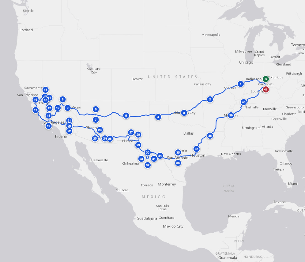
We’re planning our next big adventure: a 41-day road trip from Cincinnati out along old Route 66 to the desert Southwest and the California Sierra, then home through the Texas border country.
The route, and why counterclockwise
The route runs the loop counterclockwise so that Death Valley falls early and the Chihuahuan Desert falls later. It’s paced so that no drive day runs much over six hours, with overnight stops splitting the long legs.
West: Route 66 to Death Valley
It heads west via Oklahoma City, Palo Duro Canyon and Albuquerque to Petrified Forest and Flagstaff, reaching Furnace Creek for three nights over the new moon, the trip’s best window for Milky Way and dark-sky photography.
The Sierra and the coast
From there it climbs into the Sierra for the big trees of Grant Grove and Giant Forest, Yosemite Valley, and the condors at Pinnacles, then a day boat out to the Channel Islands.
Home through the desert and Texas
The return runs south through Joshua Tree and Saguaro, east across White Sands, Carlsbad Caverns and Guadalupe Mountains, and down the Rio Grande to four nights at Chisos Basin in Big Bend, where the high country stays in the seventies and the desert floor gets worked at dawn. The last leg comes home through San Antonio, East Texas, Memphis and Land Between the Lakes.
By the numbers
- 41 days, starting and ending in Cincinnati
- 13 National Parks, 10 of them new to us
- Lifetime total after this trip: 37 of 63
- No drive day much over six hours


Leave a Reply